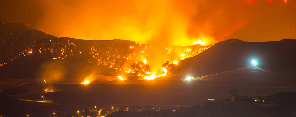
Photo credit: Insurance Information Institute
Mapping communities nationwide exposed to wildfire risks
The Wildfire Risk to Communities, an initiative of the USDA Forest Service, provides resources that help communities explore wildfire risks. The initiative provides data that allows communities to understand how wildfire risk varies across a state, region, or county, allowing them to prioritize actions to mitigate risk.
The Wildfire Risk to Communities project, the USDA says, uses the best available science to find out which communities face imminent risk of wildfire, and intensity, among other risks.
By making this data available, the USDA believes that it is empowering communities with the best resources to manage and mitigate these identifiable risks.
The data shows housing units within counties exposed to wildfires. USDA explains exposure as the spatial coincidence of wildfire likelihood and intensity within communities.
Generally, any community that is located where wildfire likelihood is greater than zero (in other words, where there is a chance wildfire could occur) is exposed to wildfire.
A simple analysis of the Wildfire Risk to Communities data valid as of March 30, 2020 shows that West Virginia, 97.5%, has the most houses exposed to wildfire. The map below also shows a higher concentration of wildfire risk around the Eastern part of the country.
Housing units in Illinois have the lowest wildfire risk, less than 30 percent.
This map shows proportion of housing units within a state exposed to wildfire risk.
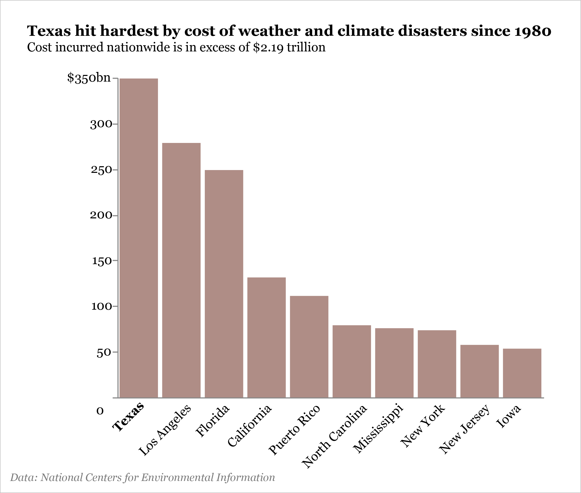
The U.S. has sustained 323 weather and climate disasters, such as wildfires, since 1980 where overall damages/costs reached or exceeded $1 billion (including CPI adjustment to 2022), according to the National Centers for Environmental Information. The total cost of these events exceeds $2.195 trillion.
These events included droughts, floods, freeze events, severe storms, tropical cyclones, wildfires, and winter storms.
In the last 42 years, Texas has been the most hit state by these disasters, incurring a cost of about $350bn.
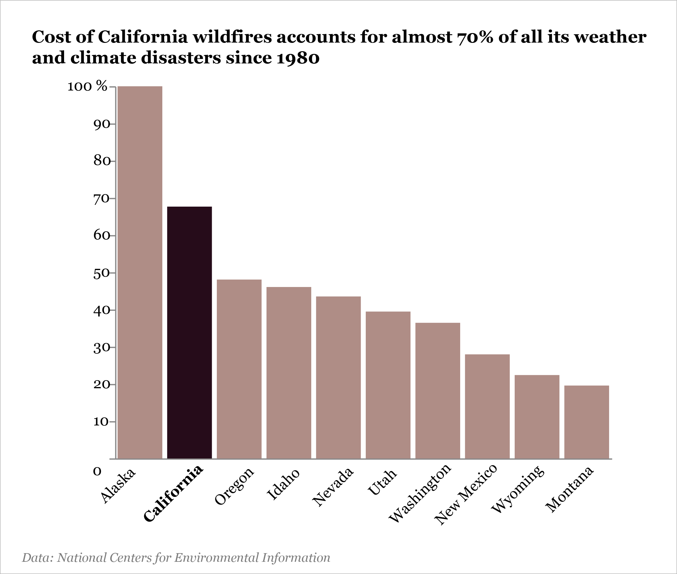
When the cost of wildfires as a percentage of the total cost of these disasters is measured by state, Alaska's proportion comes up to 100% while California, which has storied history with wildfires comes in second with nearly 70%.
A detailed breakdown of how the NCEI computes its cost can be found here.
Find the notebook used in the analysis here .